The Roubaix/L’Espierres/Spiere Canal
Two kilometres south of Wambrechies is the Canal de Roubaix, a connector between the French Deule and Belgian Haute – Escaut. It’s an interesting set up in this instance, for although a short run of 28.80km in total, the system runs through France (the Roubaix – 20km), Wallonia (the L’Espierres – 7km) and Flanders (the Spierekanaal – 1.8km): each is separately operated and there are name changes as you can see from the list above.
A Short History on the Waterway
It’s an interesting set up in this instance, for although a short run of 28.80km in total, the system runs through France (the Roubaix – 20km), Wallonia (the L’Espierres – 7km) and Flanders (the Spierekanaal – 1.8km): each is separately operated and there are name changes as you can see from the list above.
During the early 1820s, massive growth was taking place in the wool and textile industries within the Roubaix and Tourcoing region. Supply of water and coal was crucial to the continued production and growth of the companies, and with that the plans were laid for constructing a canal linking the Duele to the Haut – Escaut.
By 1821, the River Marque had been canalised from the Duele to as far as the township of Croix and 1843 saw the opening of both the section leading from Roubaix to the Belgian border, and that of the Belgian end of the canal – Canal l’Espierre.
This then left the last section – that linking Croix to Roubaix – awaiting completion.
During millennia long gone, this entire region was encased by snow and ice cold glaciers. With the commencement of the great thaw, the retreat of these snow giants was set in motion, leaving in their place sediment that eventually became covered in forests of ash, pine, oak and aspen where wolves and bears roamed free. Whilst this took place above, beneath the plateau a massive aquifer that today stretches south from Tornai was created as water inched its way along the hairline fissures that led down, down, down into the catchment below, thereby providing the perfect conditions for the creation of a picturesque swampy heathland.
Moving forward to the 1800s when the construction of the Roubaix canal took place, this swampland within what was supposed to be the Croix link, was the cause of delay after delay on this part of the scheme, as difficulties arose when excavating the drainage basin – or watershed – beneath Roubaix. These issues in turn led to rerouting this intended section of the canal farther north to Tourcoing. It was in January of the year 1877, thirty four years after the original sections were opened, that the final section of the Roubaix Canal was at last navigable to traffic, thereby providing a shorter, faster journey for the industrial transporters.
The manufacturing boom in this region was quite short lived – approximately 150 years from our calculations – as was the working lifetime of the canal which relied on the trade for its operation. By 1985, the factories had closed, the result of the manufacturing work moving to operate out of Asia and China where production costs were significantly cheaper. Resultant of this was the cessation of maintenance work on this no longer used waterway and in 1985 found it finally closed to boat traffic when numerous structures commenced broke down.
As a result of a massive campaign that pressed for the restoration of the canal network, a proposal submission requesting funding was sent to the EU in 2003. The request granted, initial works on upgrading the dilapidated network took place between 1999 and 2002, with the final section undertaken between 2008 and 2011. At the time of reopening, the total cost of restoration came to a massive fifty million euros.
Today, the initial 3km of canal is managed by the VNF since commercial barges unload at the Yeast factory found in Marcq – en – Barouel, whilst the remaining kilometres to the Belgian border operate under the Lille Metropolitan Council (MEL) and those within Belgium under the Service Public de Wallonie.
Now to our journey…….
The Research
Not desiring further transit into France this year, Bob and I chose the Roubaix as our entrance point for returning to Belgium, however our books- the Belgian ‘Nautische Atlas and Gids 2015 – 2016’ are no longer current and no updated copies are being printed. On our travels, we had also been unable to procure the French Fluviacarte 14 in boating stores, so we were left to our last resort: that of researching online.
Normally, we are not too concerned, but with water levels in some canals being critically low and contact details provided often incorrect when it comes to the lesser systems, we deemed this to be one of those times when additional info would be of benefit.
So, what did we find in our online searching? For a canal that is a link between two large systems for the pleasure boater, not a lot, and what we did find oft times contradicted, particularly when it came to water depth (ranges between 1.4m and 1.9m depending on the text) and phone numbers. It was like looking for a needle in a haystack!
Something to be aware of, is the fact that in many cases not all information in the books and online is up to date: for example, the Calais canal, Canal de Furnes, Canal Blaton – Ath (for the latter I passed on the updated information – as of 2018 – to Tom Summers who has since brought out a new updated version of his Belgian Book)
This meant that, as with our Blaton – Ath experience of 2018, we had to approach things a little differently.
Quite often there is nothing like doing things the old fashioned way, so step one took place last Saturday when, on our bike ride home from Lille, Bob and I undertook a quick diversion to check out the first kilometre or so of the canal.
What we discovered:
- The canal certainly appeared full, but that can be deceptive.
- VHF 10 channel was listed on the initial sign, but being a commercial channel, that isn’t typical for a lock contact. Of VHF 77 – listed in our book – there was no mention, nor was there a phone number.
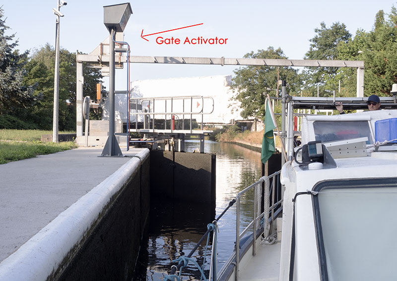
- The lock had manual operating poles inside, which in our experience meant electronic activation was required for opening the lock. Hmmm! That was unexpected, and there was no sign of an automatic activation point, so that meant a wireless controller would be required.
Still not happy, on returning to the marina, we decided a chat with the Wambrechies harbour master would be worthwhile. Being situated that close to the Roubaix, surely he could tell us something.
What a surprise Bob received, and one that would make entering the Roubaix network much easier.
It turned out that the harbour master is well versed on this waterway, hands out the electronic pads and contacts the departments who operate the system from the French end to notify them of our coming.
Once Bob had the dongle, the harbour master provided some additional detail:
- Yes, the depth was dredged at 1.9m for 1.6m draft, so all was well
- The locks and bridges aren’t operated on Sundays, so that meant a rare off day for us
- We needed to set only the first lock in motion with the electronic pad
- At 9am on the stipulated day – in this case Monday – Camille from the Lille department would meet us at the second lock and a team would take us through the remainder.
Bob even had a chat with Camille, and discovered she has an excellent command of English, which meant he didn’t have to struggle with his schoolboy French.
Did we stop our online searching? In a nutshell, no. I lost count of the innumerable word combinations we used and it wasn’t until the night before departure that I found a couple of sites – out of date of course – and Bob came across a 4 page leaflet available for the cost of 5 Euros – also out of date it proved upon showing Camille the information the next day.
This however, provided one with a history of the canal system, a list of the bridges and locks in addition to the authorities’ contact addresses and phone numbers – some of which it turned out were up to date, others not: the first four kilometres are operated by the VNF, whilst kilometres 4 – 20 are run by the Metropole Europẻenne de Lille. It also made mention of a possible scraping of bottom at the entrance to the Triest (Trieste) Lock, the result of insufficient dredging when restoration of the canal was taking place (there had been intentions for creating a small mooring area within the Wasquehal basin, commencing 2016 – this meant this leaflet was written prior to 2016).
(I have provided a pdf with all updated information for 2019 below for those who are interested and have also passed it on to Tom Summers to use in his books)
Today’s Travel……….
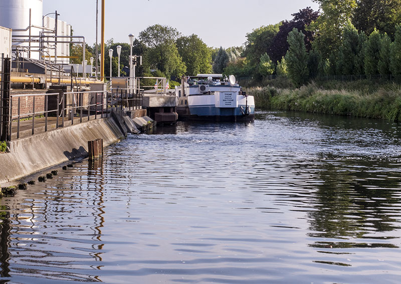
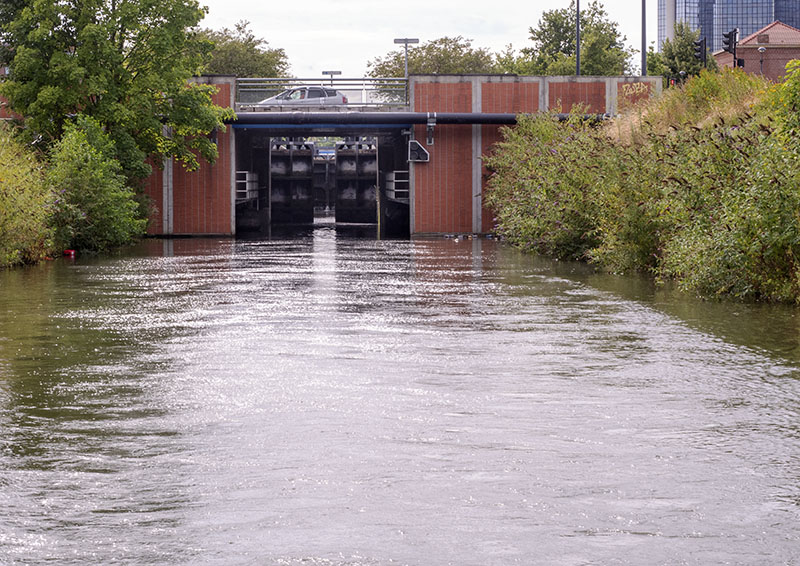
By 8:30, we had entered the Roubaix Canal
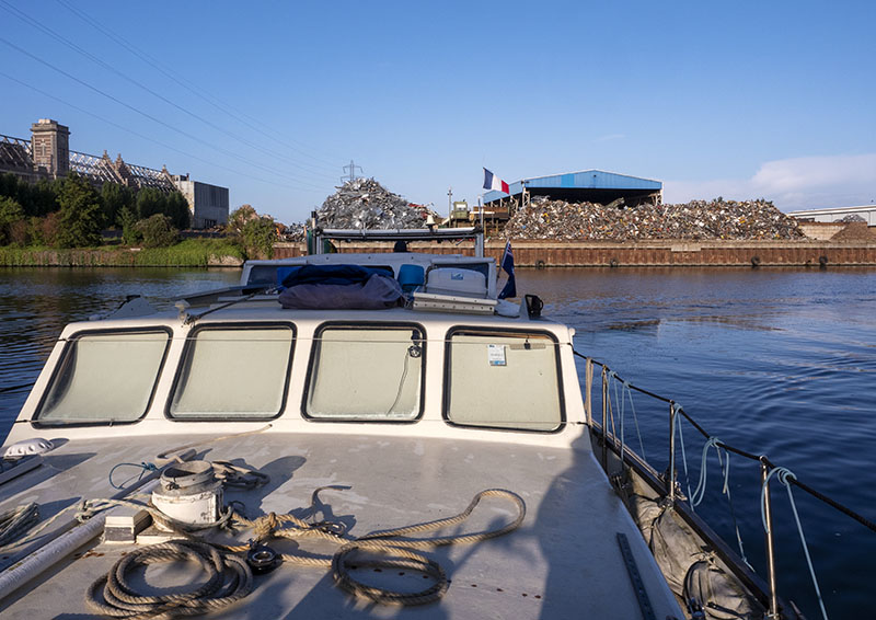
and were at the first of the locks.
where the water level appeared more than perfect.
Water depth at two plus metres was better than expected, but this was the section still utilised by commercial barges and you must know about the plans of mice and men……… In went Gratis, no problems except for the small wind gust that hit the stern on entering, thereby pushing her off centre. Nothing like a bit of excitement when attempting to keep our girl from bouncing off the lock walls!
Electronic gadget pressed, the fenders were lowered
– when full, the water is only centimetres from the top of the lock’s wall – whilst the water emptied from the lock and its gates opened.
In went Gratis, no problems except for the small wind gust that hit the stern on entering, thereby pushing her off centre. Nothing like a bit of excitement when attempting to keep our girl from bouncing off the lock walls!
With Gratis moored in the lock, the blue pole on the activator was pulled and the cycle commenced.
Yep. It was high.
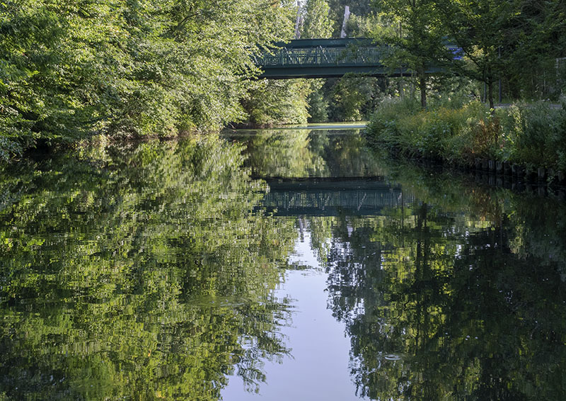
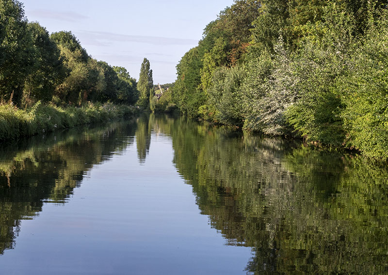
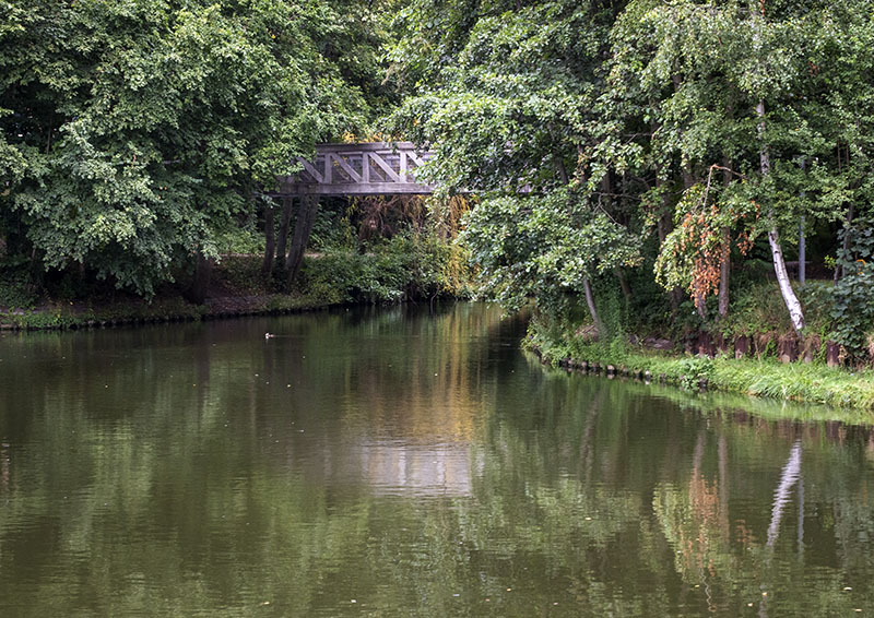
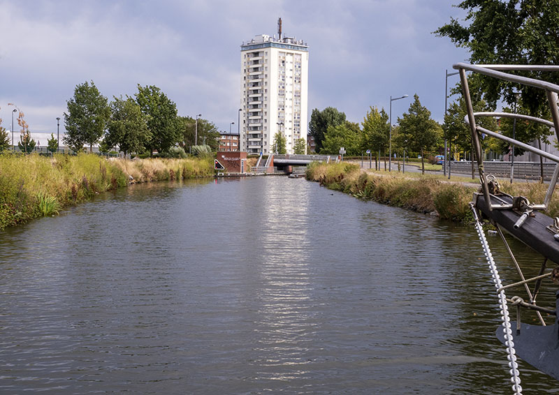
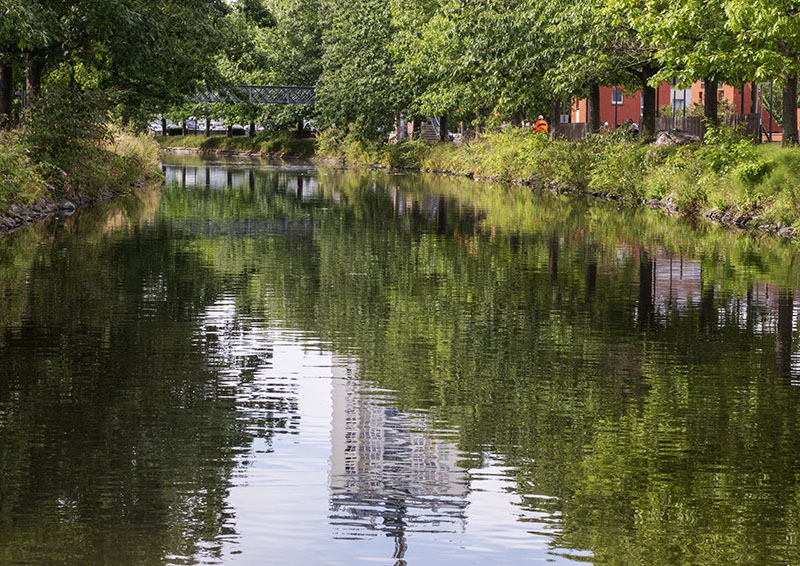
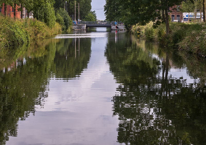
On exiting the lock, the waterway immediately became a beautifully green tree lined avenue. There was even a good sized mooring on this side.
Over the next three kilometres, depths varied between 1.9 and 2.5m, and there were occasional pontoons along the way for mooring, so all was good.
At the yeast factory, from where that defining aroma of yeast was being emitted, sat a good sized commercial barge. Being what it was, the vessel sat well out into the stream, which meant Gratis had need to edge closer to the starboard bank. Slowing her – just in case – we were pleasantly surprised to see the depth of the canal dropped no lower than 1.8m: that suited our girl just fine!
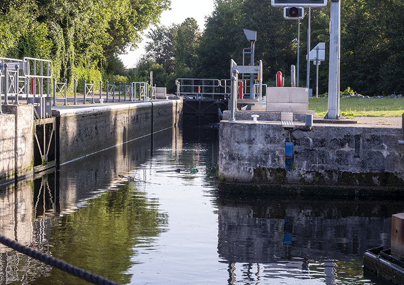
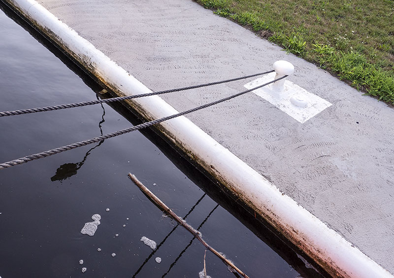
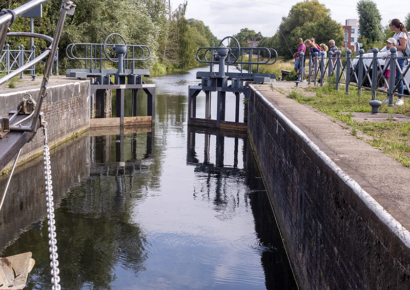
Arriving in sight of Lock Marcq – En – Baroeul, it was possible to see Camille patiently awaiting in the distance. Gates opened, in went Gratis and Camille kindly took the line, looping it around the bollard above – there are no bollards or sliding poles set within the locks on this water system, so the lock operators collect the mooring line on a hook and make it fast to the bollards high above.
Whilst the lock cycle process took place, Bob and I were introduced to the lads who were taking us along the canal system as far as the Belgian border – they spoke pretty good English and Lucas was a font of information. We were also pleasantly surprised when Camille brought out a yellow folder full of material: a plan of the canal that included up to date contact numbers, a sheet with emergency contact numbers, leaflets detailing museums worth visiting, and maps of the townships within the region. Now we were happy!
Once out of the lock, Gratis continued on her way.
People riding and ambling past did double takes on espying our girl with her kangaroo flag: it can’t be often that a boat of her ilk is seen on this waterway these days. With a wave of the hand and a smile, the call of ‘Bonjour’ regularly rang out across the water, and we cheerily responded in kind: such friendly people.
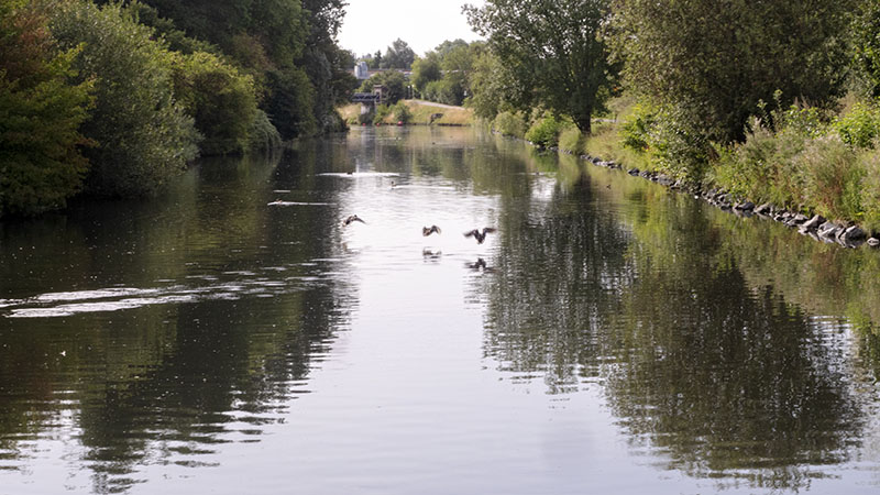
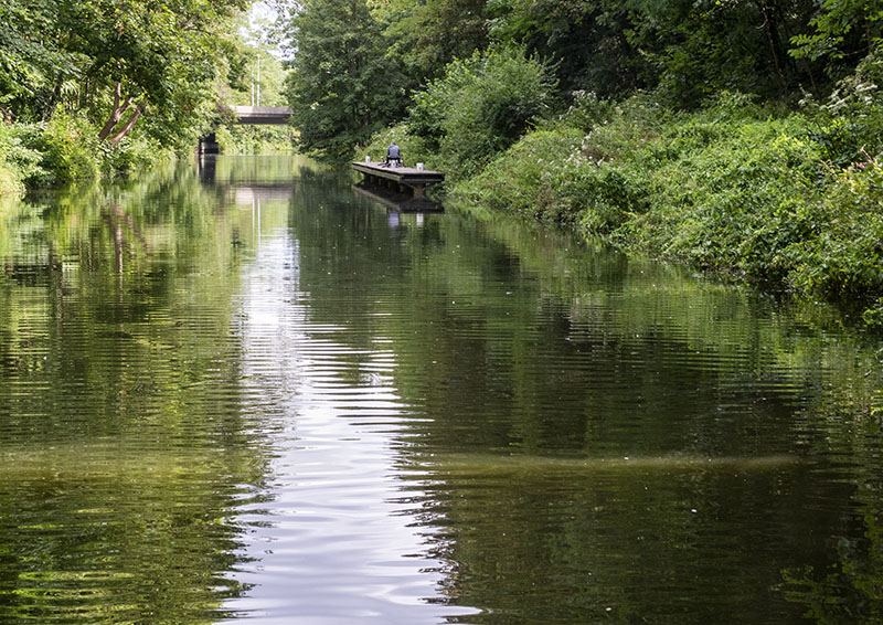
With its mix of reed and flower lined banks, tall shading trees upon which creepers grew and hues of green, the waterway really is rather picturesque: we were loving it!
There was always a small gathering of observers at the locks.
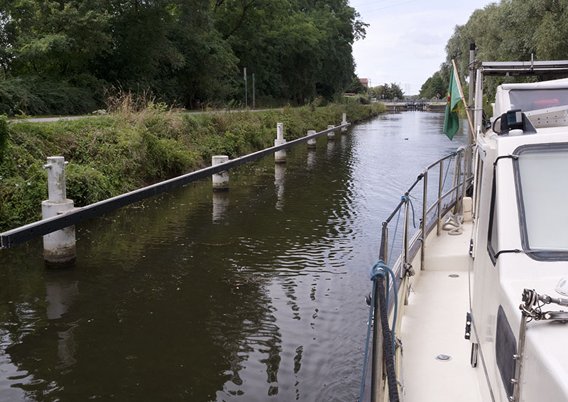
Passing beneath the bridges in the lead up to the Triest (Trieste) Lock, depths dropped to the 1.6m detailed on the new information leaflet – and occasionally lower, but in each case the touch lasted a fraction of a second before returning to almost 2m.
Having passed beneath the D656 situated just .4 of a kilometre from the Triest (Trieste) lock, it was now that the plans of ‘mice and men’ came into play and we arrived at Gratis’ nemesis as the depth suddenly dropped to 1.5m and in tandem with, it the speed. This didn’t feel like mud, though: more like weed intertwining itself into the prop.
Now within sight of the intersection with the Embranchment de Croix, that delightful suction of gluggy riverbed mud joined forces with the now visible octopus like tendrils of weed we had seconds before surmised at.
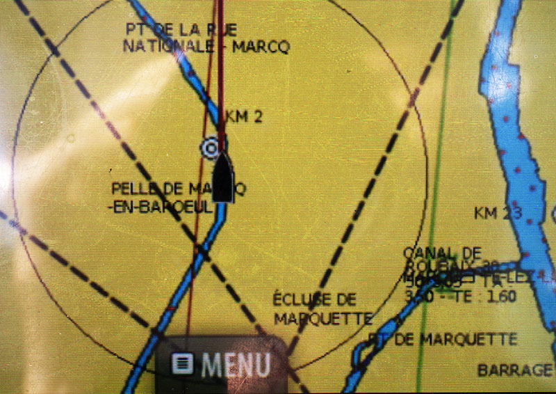
Slowed to a crawl – the depth sounder was reading 1.3m – Gratis inched her way forward, finally arriving at the junction where a ninety degree turn was required for continuing on the Roubaix. We had already learned from Camille that the redevelopment plan for the Wasquehal basin hadn’t taken place, but certainly hadn’t expected this much of a discrepancy in depth.
Because the canal centre was silted to this degree, it wasn’t possible for Gratis to be turned on her usual hint of an oily rag. With me at the bow keeping an eye out for the major low points – that was no problem here – Bob to and fro – ed back and forth, until at last the bow was pointed directly at the lock. It was a slow steady slog as twenty tons of boat with her mighty eighty five horse power engine etched a channel beneath and at long last entered her goal.
On exiting the Triest Lock, weed still slowed Gratis down a little, but the depths remained at a constant two metres right up until exiting the Masure lock, whilst the weed was no long apparent within the centre after Plomeaux.
Past the shaded entrance to the Tourcoing branch went we.
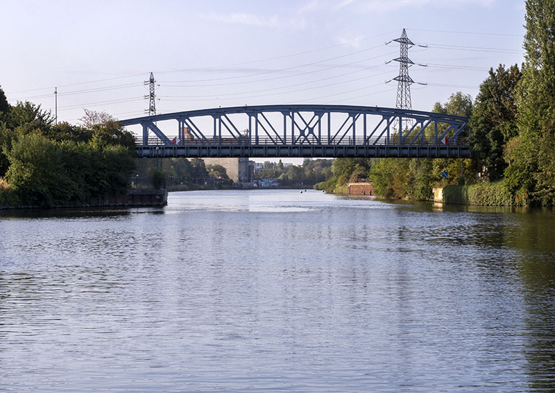
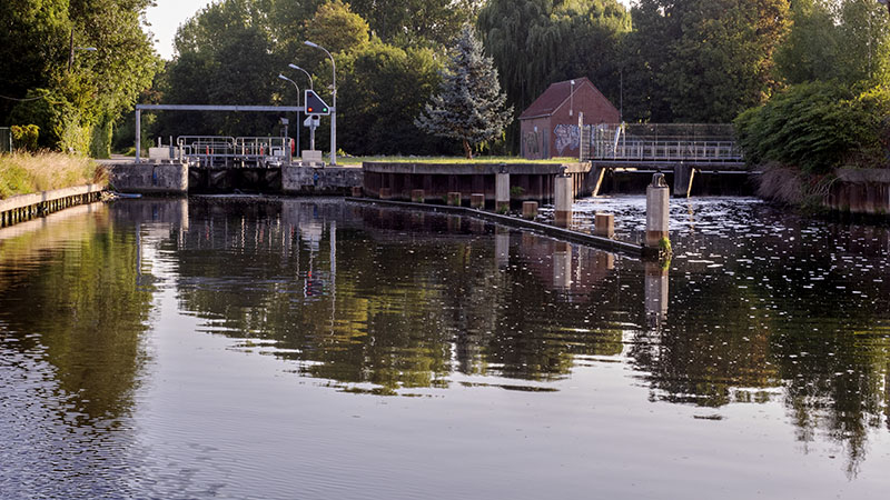
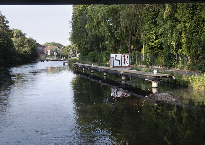
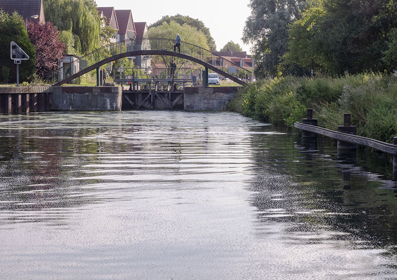
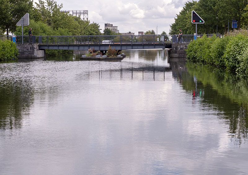
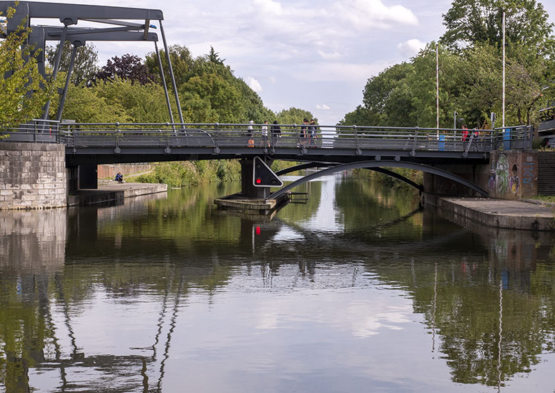
The remaining section of the day’s journey to Union lock was one in which the water traveller made passage past a number of lifting or swing bridges.
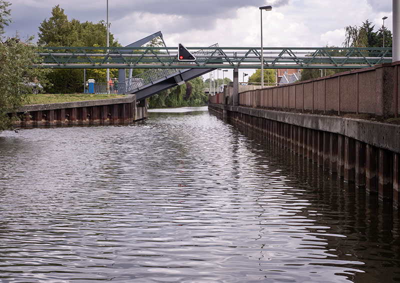
Just prior to the Roubaix Mooring area and Union Lock was the Fontenoy bridge, final opener of the day.
Intending to pass through this last swing bridge on the starboard side, Bob’s intentions came to a grinding halt as the bow commenced lifting – log????? Maybe! Apparently there were a few more cars lurking below.
Big Bertha rapidly placed in reverse, Gratis backed a little to then be redirected to port and the Tourcoing side. where she found no issue and proceeded happily on her way.
Four hours after commencing our journey on this waterway, Gratis was moored in front of the Union lock where, with the coming days predicted to be grey and wet, power could be connected – or so we and our lock operators thought.
The power outlet itself is situated within a box in the ground at the Union lock area and is opened with a key with which Bob had been provided. From where we were situated, there was need for our 50m long power cable, but being the only boat in the basin it was possible to move further forward had we so desired.
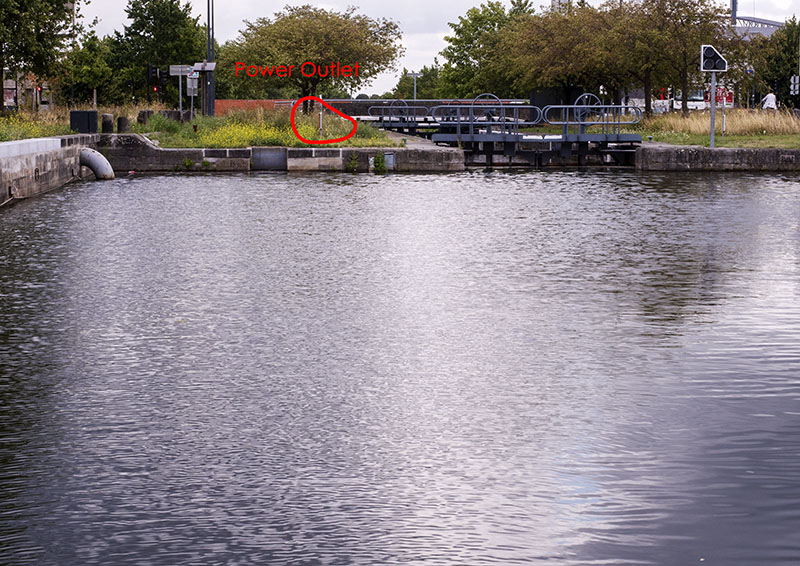
Power cord connected, we were ready to roll, but not so the power. There was no energy emitting from any of the four connections. Taking hold of his power metre, Bob headed down to undertake a check – being an ex – electronics engineer has its pluses: there was no reading whatever, which meant the switch for the electricity being fed to this connection was turned on elsewhere.
Lunch over, a phone call was made to Camille and it wasn’t long before there was a knock on the hull. Heading down to the lock with her, Bob and Camille searched in vain for the missing connection post. It was holiday for the person who dealt with this side of things, so the poor girl couldn’t do anything to solve the issue here at this point of time. However, after a phone call and chat with some of the lads, she was informed electricity was available further down the canal and arranged for some of the team to come and take us through.
Their lunch break complete, by mid afternoon the lads had arrived and Gratis was on her way.
Whilst in the lock, Lucas informed Bob that a car had been driven into the canal some time back and was still there. It was positioned on the right bank just round the bend – between Pont des Courteaux and Pont Daubenton. He recommended we keep to the left.
The Conteau Bridges were an interesting setup.
With a massive round about setup on the Roubaix side bank, multiple roads led in all directions.
Now, back to that car.
Well, we found it! In the almost still water, from the bow it was possible to sight the vehicle’s white hood just a few metres ahead. With the marriage savers still not working, it required some doing for Bob to comprehend that Big G was close to running over the vehicle!! Full reverse throttle placed on Big Bertha, our girl came to a ‘grinding’ halt and commenced reversing. Situated between passerelle Hutin at km 13.8
and Pont Daubenton at km 14.2,
the vehicle had moved and was now situated a little more left of centre than it was to the right of the waterway, so one had need to cautiously proceed quite close to the rocky left bank of the canal – for us heading in an easterly direction, this was the incorrect side of the stream.
(Bob and I returned to the scene the following day and took some detailed shots from the bank.)
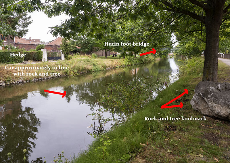
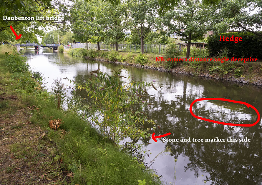
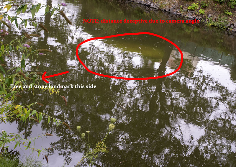
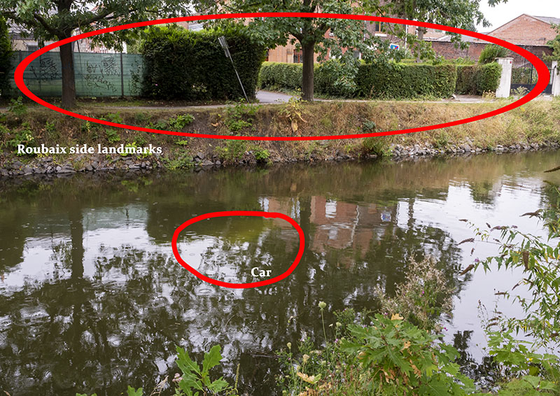
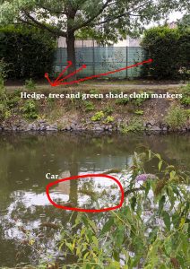
As the locks empty and fill, the massive water flows emitted have a habit of moving even large objects around.
Excitement of the day over, a couple of lift bridges traversed,
and Gratis soon found herself at her new mooring. Here, the electricity box was right alongside, the power worked, and we were much closer to Roubaix’s centre with an Aldi right on the doorstep: what more could we ask for!!!!!
When departing the guys showed some concern as the area was reknowned for its unemployed and the theft rate that went hand in glove. Advised to store our bikes inside overnight – not that easily done – Bob and I were advised the police had been informed of our presence and would make passes throughout the night, had our attentions drawn to the police contact on our sheet and were told not to hesitate using Camille’s emergency number should the need arise. Bikes chained to the port side rail, as far from the canal bank as possible, we settled in for the night…..
Despite the few depth issues encountered, we delighted in this day’s journey upon the Roubaix and didn’t regret one moment of it.
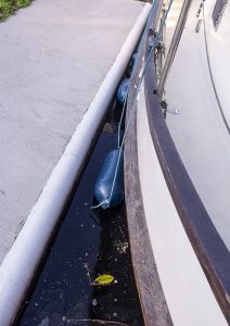
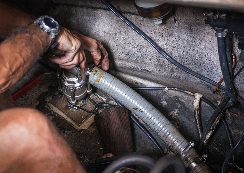
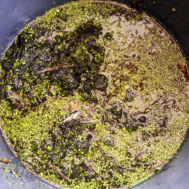
Oh yes, remember all of that weed and the dredging Gratis undertook?
During the lunch break, Bob got to work and emptied an array of green from the filter and hoses.
Notes
- Gratis has a draft of 1.45m and there is about 100mm leeway on our depth sounder as Bob provided this when creating the settings – so when reading at 1.5m, the depth will be more like 1.6m, give or take. What we provide in our notes here is what we are reading on the depth sounder.
- Gratis’ engine water inlet is set on the bottom of the hull and goes through a large filter box. The ‘wonderful’ weed that assisted in slowing Gratis down, also entered the system, blocked part of the pipe and totally filled the basket. This is something to be aware of if your boat has a deeper draft.
Interesting Facts
- Grey water from the towns around is sent up to the Roubaix catchment where a filtration plant cleans the water before feeding it into the canal
- Prior to going on holidays, the person in charge of the water levels fills the canal to the brim, thereby catering for the pleasure boats expected to pass through during his break.
Our Notes (I have also passed these and images on to Tom Summers who does http://www.eurocanals.com )
Information on Waterway from MEL, Lille authority
Roubaix Information
Roubaix – Tourism & Holiday Guide